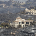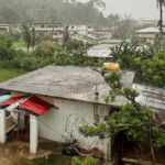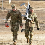
Artificial intelligence and satellite technology are playing a growing role in the emergency response to the twin earthquakes that struck Venezuela, helping rescue teams identify the areas most likely to have suffered severe damage while the search for survivors continues.
Space agencies, technology companies and international organizations have activated a range of geospatial analysis tools that combine satellite imagery with AI to provide rapid assessments of the disaster. The technology allows emergency responders to prioritize rescue operations by identifying neighborhoods where buildings are most likely to have collapsed or sustained major structural damage.
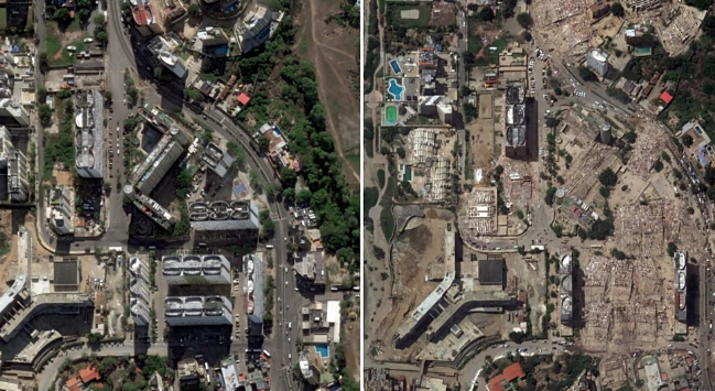
Among the organizations supporting the effort is NASA, which has activated its disaster response programme in partnership with researchers from Oregon State University. The team is comparing radar images taken before and after the earthquakes to detect changes in the landscape and damage to buildings.
Using the initial analysis, scientists estimate that nearly 59,000 buildings may have been damaged or destroyed. While the figure remains preliminary, it provides emergency officials with an early picture of the scale of destruction and helps determine where search-and-rescue teams should be deployed first.
The analysis depends on radar imagery collected by the Sentinel-1 satellites, part of the European Copernicus Earth observation programme operated by the European Union and the European Space Agency. The satellites can detect ground movement with remarkable precision, measuring shifts of only a few centimeters and identifying structural changes in buildings following an earthquake.
Artificial intelligence systems process these satellite images to detect patterns that may indicate damage. Rather than examining every image manually, computer vision models quickly analyze thousands of locations and classify buildings according to the likelihood of structural impact.
Microsoft has contributed through its AI for Good laboratory, which has developed automated image analysis tools designed to accelerate damage assessments after natural disasters. The company said the technology is intended to support, not replace, emergency personnel by helping authorities decide which locations require immediate inspection.
The resulting damage maps are shared through the United Nations Centre for Humanitarian Data (HDX), allowing governments, humanitarian agencies and rescue organizations to access updated information from a common platform. Officials say the shared database improves coordination among responding agencies and reduces duplication of effort during large-scale emergencies.
Experts caution that AI-generated assessments remain estimates rather than confirmed reports. Physical inspections are still required to verify damage and determine the condition of buildings on the ground.
Even so, disaster specialists say the combination of satellite imagery and artificial intelligence has become an important tool in modern emergency response. When thousands of structures may be affected and time is critical, rapid damage assessments can help rescue teams reach the hardest-hit communities more quickly and improve the chances of finding survivors.